{photo by Art Projects for Kids}
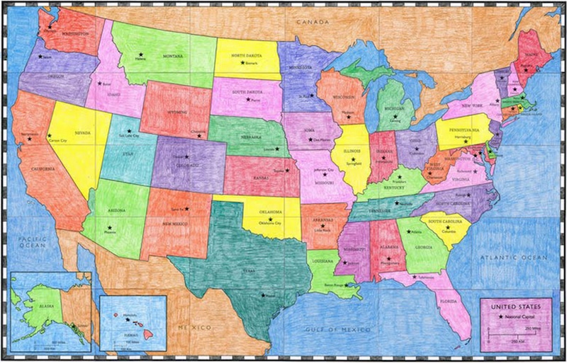
Greetings! This week we are going to veer slightly from our usual list of mix-ins, and throw in some fun geography links to focus on learning the US States (and Capitals, if you’re interested). Here’s an assortment of resources your kids can use at home to help learn where the states are, and more about them. Some of the videos are a little corny, but we hope you enjoy:
VIDEOS:
Fifty Nifty United States – Remember this from back in the day? Introduce your kids to this classic and sing along! In this version, the video is partly taken from Schoolhouse rock, but also uses some clever images for each state:
Fifty States the Rhyme – Here’s another states song with a different tune, and the video shows each state on the map, their flag, and the number in which they were admitted to the Union:
There are several songs to help learn the states and capitals – here are a few to choose from! Your kids can pick their favorite:
Wakko’s 50 State Capitols – This is an Animaniacs clip with a catchy little tune to learn the states and capitals:
States and Capitals Song by Musical Stew – Here’s another way to learn the states and capitals, with a silly song and video:
Tour the States – This rap song goes through all the states and capitals while they are being drawn in fast motion:
And a few more videos about the states:
Every State in the US – This video introduces the states with a few interesting facts about each:
The 50 States in Order of Statehood Animation:
The Scrambled States of America | Read Aloud – A fun book for kids about what happens when all the states decide to rearrange themselves:
WEBSITES:
Basic Map of the US States and Capitals
The U.S. States – From National Geographic Kids, this site has info on all 50 states (plus Washington, D.C.), with photos, flags, fun facts, history, wildlife, and more!
Explore the States – Facts about each state, from the Library of Congress.
Learn About the States – Links to government websites for each state.
Can You Name the US States? – You can use this in a couple of ways. To learn where each state is, use this “game” to enter the name of a state, then the computer will show you where it is. Or see if you can remember the names of all the states as you keep going and filling in the map.
USA Geography Puzzle Map – There’s an “easy” and “hard” level, so this is a great way for all ages to learn the shapes of the states.
US States and Capitals Map Puzzle – This is similar to above but there’s a “Capitals” version so you can test yourself to see if you know the capitals too.
USA Map Jigsaw Games – One more! Again, this is similar, but there are levels that start out easy, by region, and work up to more difficult with no borders shown.
USA Games – Several different games about the Capitals, States, and Landscapes of the US, all with levels.
Can You Find the United States on a Map? Quiz – This is fun and a little addicting! Click on each state when prompted (and yes, you’re being timed). Parents, see if you can place all the states, then let your kids try!
United States Map Quiz – This game is like the reverse of the one above. The state is highlighted on the map and you have to click the correct name.
USA Map Jigsaw Puzzle – This shows the whole country and all the states at once, and you drag and drop them into the correct place.
Ben’s Guide: Place the States – This is similar to the game above but slightly easier, as the shape is highlighted when you get near it.
State the State – This tests your knowledge of each individual state when they are shown by themselves, so you really need to know the shapes. You can either play a multiple choice version, or a version where you have to type in the name of the highlighted state, AND spell it correctly. There are also easy and hard levels.
Fifty States for Kids: Maps, Facts, Games, and Activities – From Mr. Nussbaum, there are lots of online activities and printables here.
Discover America Through Postcards – Take a virtual tour through the states with postcards! This site is from a couple who toured all the states, took photos, and wrote about each one, postcard-style. It’s a fun way to learn a bit about each state. (Scroll to the bottom for the link to see the postcards.)
Also be sure to check out the school store for more geography and US games, puzzles, and other fun items!


